If waking up to the Tetons is your dream, the stretch north of Jackson can deliver a skyline you never tire of. In this part of Jackson Hole, views are special and rules are specific, so a smart purchase takes careful homework. In this guide, you’ll learn where views are strongest, which overlays and easements protect (or limit) them, what site constraints to check, and how to value a true Teton panorama. Let’s dive in.
What “north of Jackson” means
When a listing says “north of Jackson,” it can sit inside the Town of Jackson or in unincorporated Teton County. The Town and County use different land development regulations and permit paths. Start by confirming jurisdiction, then review the applicable rules and overlays. The Town’s process and height rules are on the Planning & Building page, and County standards are in the Teton County Land Development Regulations.
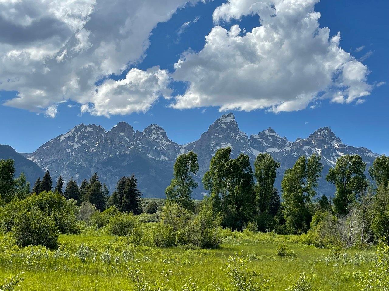
Where Teton views are strongest
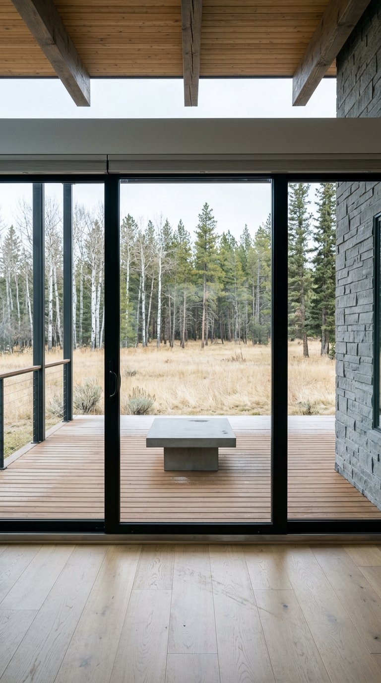
The valley floor frames the Teton Range to the west. Parcels north of Town often look across meadows, river corridors, or low ridgelines toward the peaks. Large, open meadow settings and bench sites behind them can offer broad, lasting sightlines. Many of these foregrounds and skylines are mapped in the County’s Scenic Resources Overlay, so check the official LDRs and the County’s map resources at jacksontetonplan.com.
Pro tip: walk the site morning and afternoon, and again in a different season if possible. Sun angle, leaf cover, and snow can change how much of the skyline you actually see from living areas.
Rules that shape your view
Scenic Resources Overlay (SRO)
If a lot sits in the SRO, the County may require a visual resource analysis and apply siting, scale, and screening standards that keep buildings from interrupting frequently viewed skylines. Expect additional review and possible conditions of approval. You can read the SRO standards in the County LDRs.
Natural Resources Overlay (NRO)
Where the SRO overlaps the NRO, wildlife and waterbody protections can reduce the buildable area and change where homes may be placed on nearby parcels. That can indirectly protect your view by limiting adjacent development. Always check both overlays together in the County LDRs.
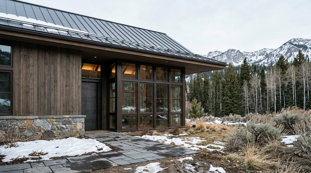
Height, envelopes, and jurisdiction
Height and bulk limits vary by zone and by whether you are in Town or County. These rules help protect scenic character and can influence rooflines, chimneys, and deck rail heights. Verify the applicable zone and standards with the Town’s Planning & Building page or the County LDRs linked above.
Easements and private protections
The most durable view protection usually comes from recorded conservation or view easements. In Teton County, many meadows and river corridors are under easements held by county or local land trusts. Learn how these work through this overview of the Teton County Scenic Preserve Trust. Always pull title and request copies of any recorded easements on the subject and adjacent parcels. Read the reserved rights, since some easements allow limited homesites or vegetation management. Also review any HOA covenants for height or tree rules.
Infrastructure and site constraints
Floodplains
Parts of the Snake River corridor and nearby creeks sit inside FEMA flood zones. Building in a Special Flood Hazard Area often triggers elevation requirements and a floodplain development permit. Confirm status using County resources on Floodplain Maps and Studies.
Wastewater and sewer
Many County parcels north of Town are not on municipal sewer. You may need a Small Wastewater Facility permit with soils testing and setbacks. Start with the County’s permit resources listed in the site map and confirm feasibility before assuming large-scale construction.
Wildfire and WUI
Wildland-urban interface risk is real in this landscape. Plan for defensible space, possible mitigation work, and insurance considerations. Teton County’s wildfire guidance offers practical steps on the What You Should Do in the Case of a Wildfire page.
Access, utilities, and snow storage
Ask who maintains and plows the road, and whether it is public or private. Confirm power is available and note whether lines are overhead or underground. Identify where snow will be stacked, since winter storage can influence driveway siting and outdoor living areas.
Trees and seasonal sightlines
Tree growth or removal can change a view over time. If your view depends on a specific tree line, get a survey of tree locations and ownership and consult an arborist. The County discourages indiscriminate clear-cutting in mapped scenic areas, as outlined in the LDRs.
How to price a Teton view
Teton County is a high-value market where mountain views are already capitalized into prices. Local data can provide context as you review comps, such as the county snapshot on Realtor.com’s Teton County market page. There is no universal percentage for a “view premium.” The premium depends on view quality, rarity, protection from future obstruction, buildability, and current buyer demand.
Professionals support adjustments through sales comparisons, paired sales when available, and photo-documented view ratings. For conservation-easement impacts, appraisers often use the “before and after” method, explained in this overview of conservation easement valuation. For a specific parcel, the best step is to hire a local appraiser who regularly values Teton-view properties.
Here is a simple plan:
- Pull 3 to 5 MLS comps that explicitly describe Teton views. Note sale speed and any recorded protections nearby. Use county-level context like the Realtor.com page to frame demand.
- Order a local appraisal with a written view narrative and supporting photos taken from the home’s likely living areas.
- Review title on the subject and adjacent parcels for conservation easements or restrictive covenants that reduce the risk of future obstruction.
Due-diligence checklist
Request these items before you remove contingencies:
- Official zoning and overlay maps for the parcel, including SRO, NRO, and any floodplain layers. Start at jacksontetonplan.com.
- Full title commitment with Schedule B exceptions. Ask for copies of any recorded easements or CC&Rs. Review reserved rights.
- Topographic survey with potential building envelope. Consider a drone or photogrammetric view-shed from likely living areas.
- Any Visual Resource Analysis or Development Plan already prepared, if the parcel lies in the SRO. Check the County LDRs and public documents portal for prior submittals.
- FEMA flood map excerpt and any elevation certificate requirements if the lot is in a mapped flood zone, using Floodplain Maps and Studies.
- Soils and septic feasibility or Small Wastewater Facility permit status. Begin with County permit listings in the site map.
- Wildfire risk overview or Firewise-style assessment. See County guidance on wildfire preparedness.
- Utility maps and any private road maintenance agreements.
- A short memo or pre-appraisal note from a local appraiser focusing on the view and likely adjustments.
Red flags and opportunities
Red flags
- “View protected” is claimed, but there is no recorded conservation or view easement. Ask for recorded instruments. See the overview of local easements and trusts at the Jackson Hole Conservation Alliance.
- The lot lies in a mapped floodway or Special Flood Hazard Area and would require significant elevation or restrict placement of habitable space. Confirm on Floodplain Maps and Studies.
- Achieving the view requires heavy tree removal on a site within the SRO or NRO, where clear-cutting is discouraged under the LDRs.
Opportunities
- Adjacent public land or recorded conservation easements that reduce the risk of future obstruction can make a view more durable. Learn more about local easements via the Scenic Preserve Trust overview.
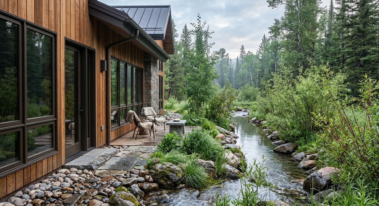
- A site that allows you to orient living areas and decks toward the Tetons without major grading or tree work often means lower costs to keep the view.
Smart site visits
Bring a simple view plan to your showings. Mark likely kitchen, living, and primary bedroom locations on a topo map, then stand at those points at eye height. Visit at different times of day and, if you can, in a second season. A quick drone or mast photo session can help you model second-story or roof-deck sightlines before you commit.
A focused first step
Before you bid, confirm three public records: whether the parcel sits in the SRO or Town zoning with visual review standards, whether nearby parcels carry recorded conservation or view easements, and whether any portion of the lot lies in a FEMA flood zone or within the NRO. Ask your agent to attach the relevant maps and recorded instruments to your offer and to order a local appraisal that explicitly adjusts for view quality. You will enter negotiations with clarity and fewer surprises.
Ready to secure the right Teton view with confidence? Partner with a local advocate who knows every overlay, easement, and ridge. Reach out to Jennifer Reichert for a tailored plan to source, vet, and negotiate your Teton-view home north of Jackson.
FAQs
What is the Scenic Resources Overlay in Teton County?
- The SRO identifies frequently viewed foregrounds and skylines and requires visual review, siting, and screening standards to keep buildings from interrupting scenic vistas, as outlined in the County LDRs.
How do conservation easements protect a Teton view?
- Recorded easements can permanently limit development on a parcel, lowering the risk of future obstruction; always verify recorded instruments and terms and review local context like the Scenic Preserve Trust overview.
How does being in a floodplain affect my build?
- Building in a mapped FEMA flood zone often requires elevation certificates and a floodplain development permit, which can affect design, insurance, and cost; confirm status via Floodplain Maps and Studies.
What should I know about septic on county parcels?
- Many parcels are not on sewer, so you may need a Small Wastewater Facility permit with soils testing and setbacks; begin with County permit resources in the site map and confirm feasibility early.
Is there a standard “view premium” for Jackson Hole homes?
- There is no universal percentage; appraisers adjust for view quality, rarity, protection, buildability, and current demand using local sales comparisons and, for easements, methods like “before and after” valuation outlined here.